jcg
Jessamine Creek Gorge (JCG)
Welcome to my mapping repository for Jessamine Creek Gorge for Boyd Shearer’s GEO409!. From here you can find the many maps I have made of JCG for class!
The Jessamine Creek Gorge Area is home to Overstreet (Jessamine) Falls, a waterfall flowing down from one of the many steep cliff faces formed by the karst landscape. Jessamine Falls feeds directly into Jessamine Creek, which continues to the Kentucky River greater Palisades.
Check Out This Project
Home | Cliff Index (L8) | Mapbox Webmap (L8) | Videographic Tour (L7) | GeoPDF of JCG (L6)
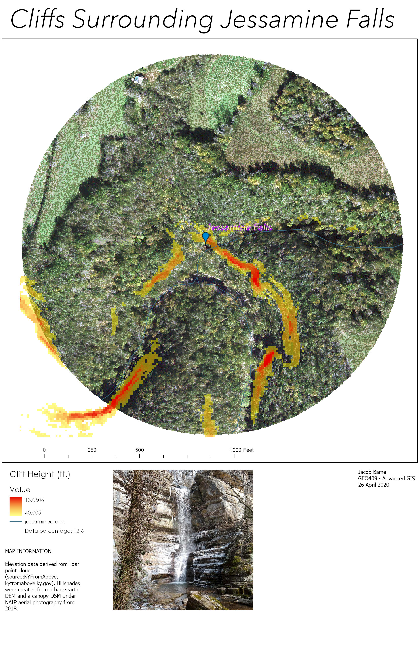
Cliffs in Jessamine Creek Gorge and an Aerial Tour (Lab 7)
This map shows where cliffs are located directly surrounding Jessamine Falls.
Here is a video aerial tour past Jessamine Falls!
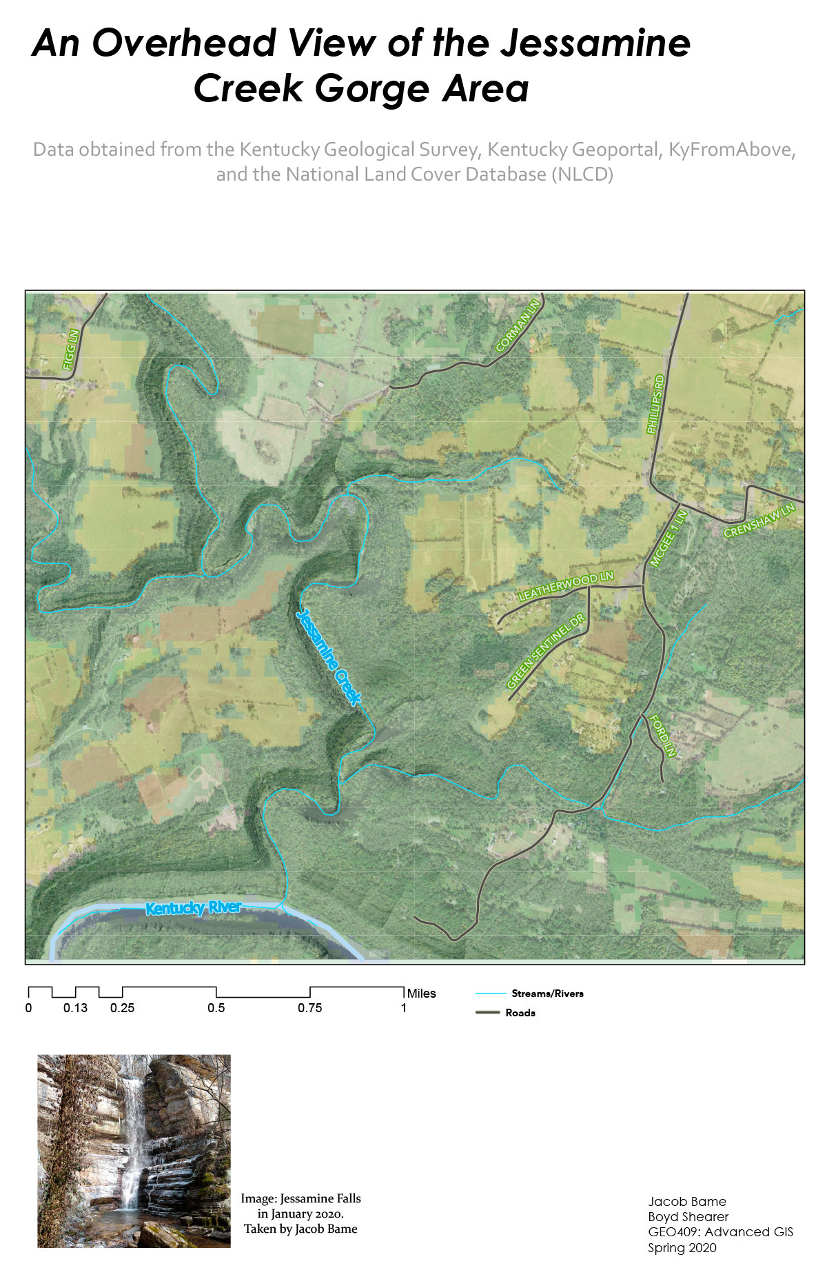
A Base map of Jessamine Creek Gorge (Lab 6)
Download a GeoPDF of Jessamine Creek Gorge
REMINDER: Please respect Nicholasville law enforcement and avoid visiting the trails if they are closed for quarantine. :)
Preview of map
Photographs
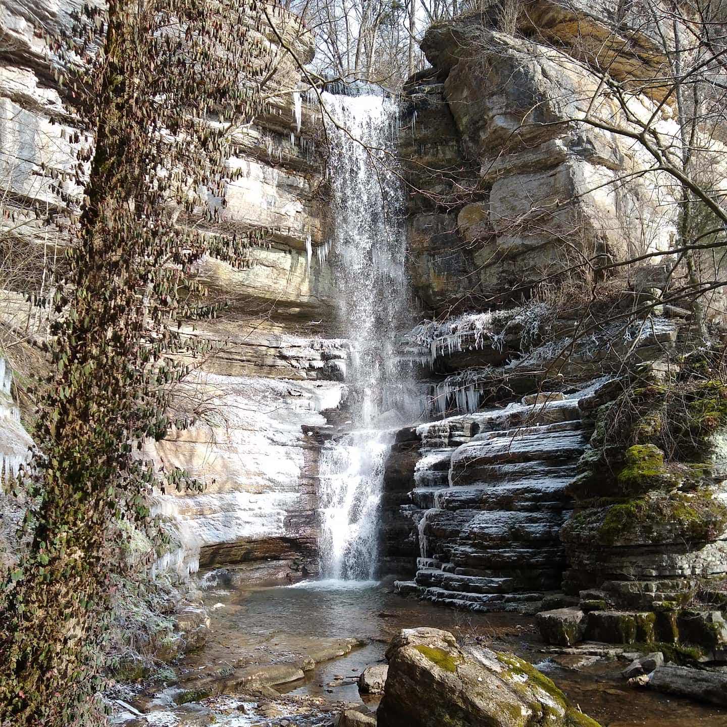
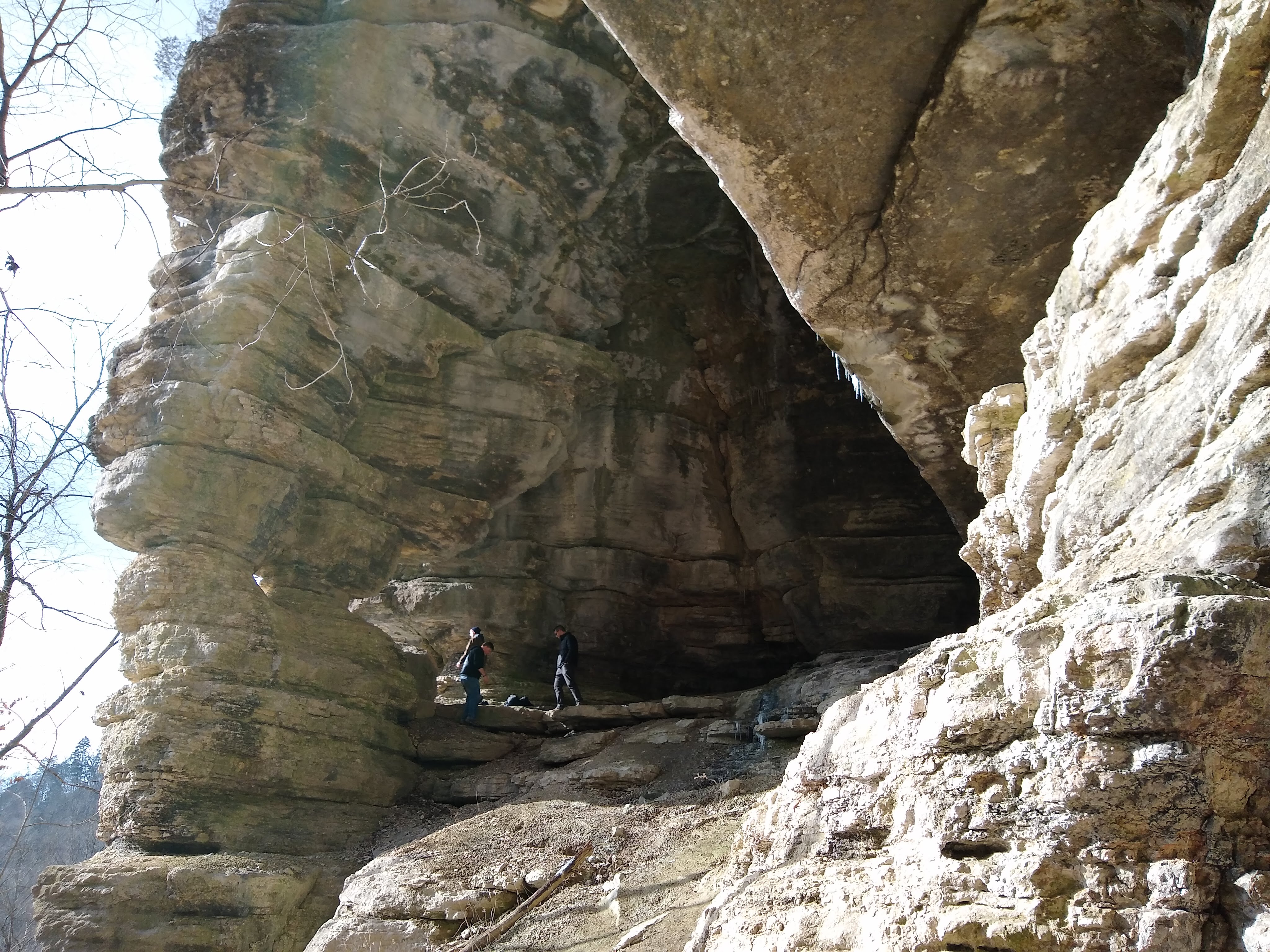
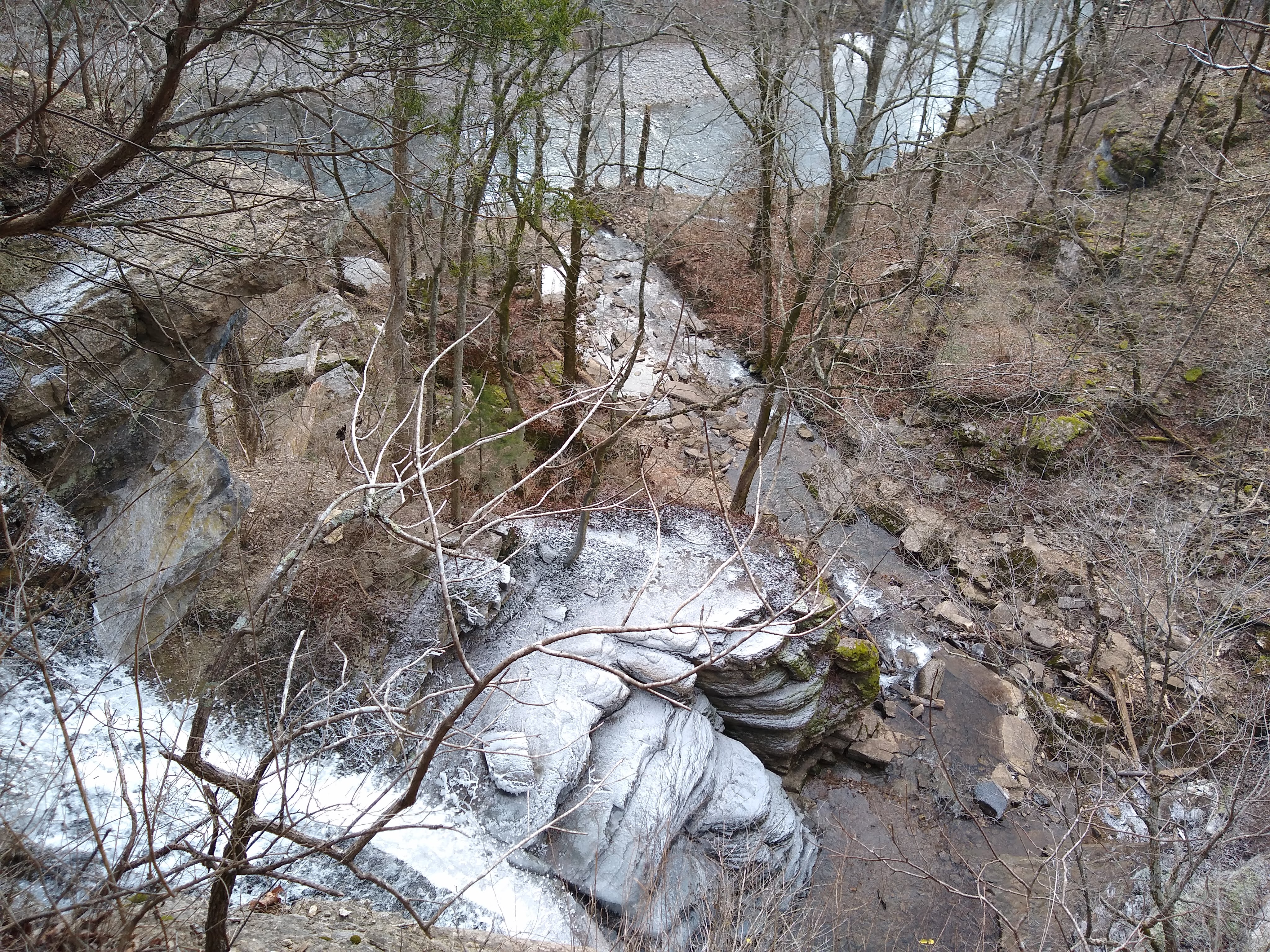
All images taken by Jacob Bame, January 2020.
To contact me: email at jeba239@uky.edu