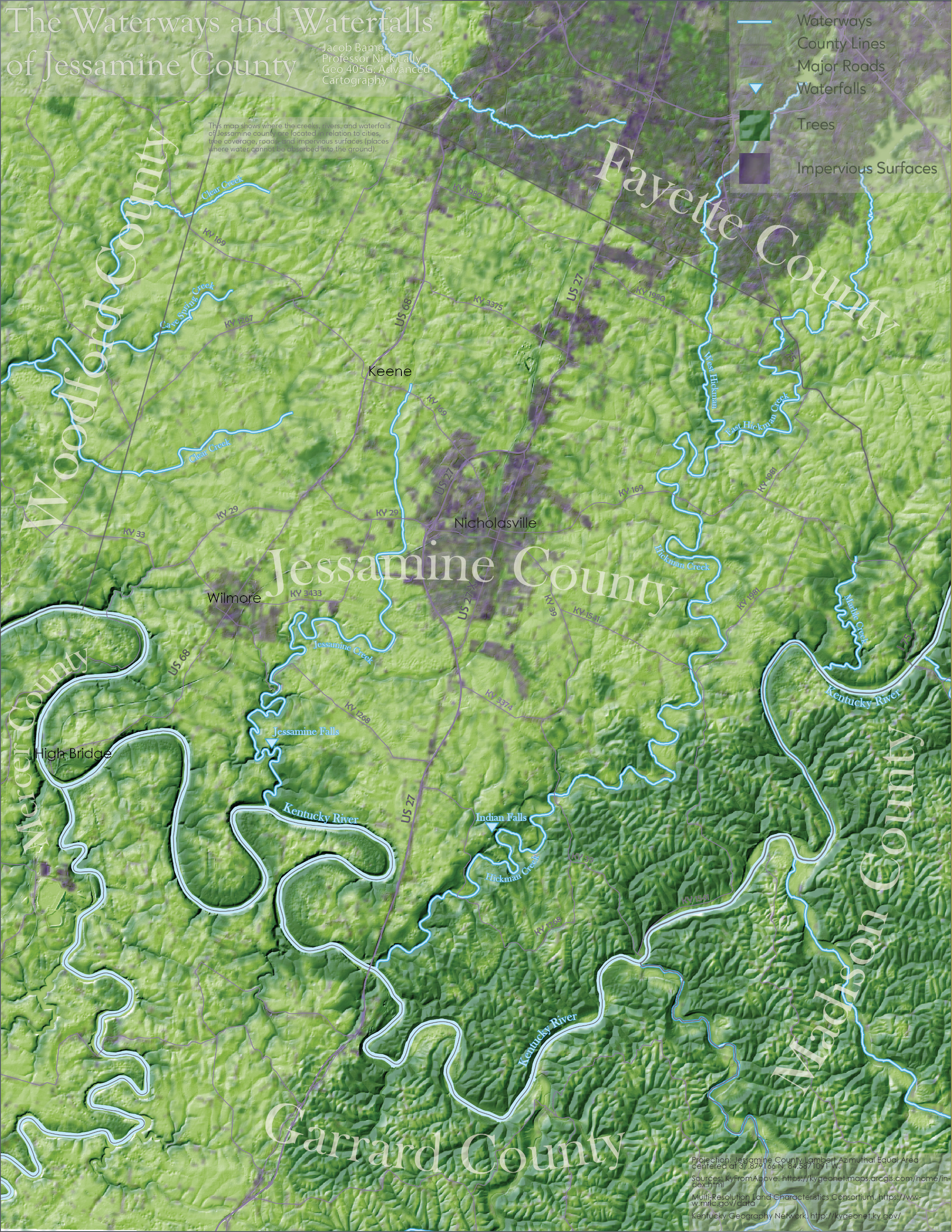
This map, while originally made for my GEO305: Elements of Cartography course, was redone for GEO405: Advanced Cartography to give it a much cleaner feel with an improved color scheme. It serves the purpose of showing the major waterways of the county in context of the surrounding terrain. However, also taught me to consider how colors do not appear the same when printed as they do on a computer screen.
Have a question or Comment about my work? Let me know via email at jacobbame99 [AT] gmail *DOT* com. Alternatively, call or text at EIGHT FIVE NINE 489-6078.